Translate

Showing posts with label montana. Show all posts

Friday, August 14, 2015

Lucky Seven

Day One : Here We Go Again
Day Four : Venturing Fourth
Days 5-6 : Pleading the Fifth

We started the seventh day, Saturday, August 1, in Butte, Montana. After checking the NPS website for the latest on the wildfires in Glacier National Park, it seemed we'd have no luck in being able to view a glacier at the singular viewing point along Going-to-the-Sun Road. Since Glacier was a bit out off our I-80 "track" anyway, we figured we'd just stop at whatever looked interesting as we continued westward towards Idaho.

The first place we encountered that fit the bill was in Deer Lodge, Montana. A brown informational sign along the highway stated that the Grant-Kohrs Ranch was at that exit, and I asked mom if she wanted to stop. "Sure" was the response.


We arrived just as the Park Ranger was opening up the visitor center, and he asked us if we'd like to do the house tour. It seemed like something cool to do, so we signed up; as early as it was, we were the only ones in the tour group. With the magic placard, we were allowed to drive over to the house and park closer, while the ranger -- whose name was Ken Kraushaar, amusingly enough -- walked the path between the visitor center and the house.

We weren't allowed to take photos in the house, so you'll have to take my word for it's amazingness. Like the Prairie Homestead, it was full of historic pieces, though these were in much better condition. Virtually everything in the house was just as it was when Conrad Kohrs lived there, and his parents were evidently extremely tall people if the mirror positions were any indication (I could barely seen my face from the chin up in the master bathroom.
The front of the ranch house, which has 12 or 13 bedrooms
The back of the ranch house, including the "winter patio" (what we'd call a greenhouse)
The Kohrs family had a monstrous cattle empire that extended up into Canada, and was one of the first millionaire families in America. Despite some lean years in the late 1800s, diversification of his empire allowed Kohrs to stay in business even as other cattle ranchers failed.

After the tour, we wandered the ranch grounds, talking with the woman running the chuckwagon (she was from Annapolis!), looking at the variety of phaetons and carriages in the stables, and watching the beautiful Percheron and Belgian horses.
Coffee's ready

Sulkies weren't always for racing
Blacksmith shop at the end of the stables
Workhorses
As soon as they noticed us, they came trotting over, looking for treats or something
Ranger Ken asked us what we planned to do next, and after hearing that we felt we needed to scrap our plans for Glacier, he suggested that we look at going to the National Bison Range outside St. Ignatius. It sounded intriguing, so we plugged the address into the GPS.

There are essentially two roads you can take around the range. One, Red Sleep Mountain Drive, goes to the right and circles around the range. The other, Prairie Drive, goes to the left, and meets up with Red Sleep Mountain halfway around. At that point, you have to turnaround and go back the way you came.

In the visitor center, there are displays that show where current sightings of animals are. Many bison had been seen along Prairie Drive, plus mom didn't like the idea of a one way dirt road with no guardrail and a steep embankment on the right. I had taken over driving duties by this point, and while the idea didn't phase me too much, I didn't need to hear sucking wind every time she got nervous as it started to make me nervous too. So, we stuck with lower road.

There were bison galore, both close to the road and far.


We also saw a herd of elk in the distance.

And pronghorn antelope and mule deer.
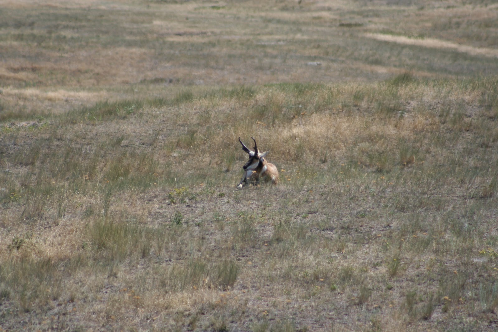


The only animals that we didn't see -- the bighorn sheep and mountain goats -- would have likely been in the upper altitudes of Red Sleep Mountain Drive.

The visitor center was actually out of postcards (the horror!), so we stopped at a little gift shop just off the grounds. We also picked up some local ground bison there, as well as huckleberry honey. Just the thought of the bison had my mouth watering. Mom stuck it in the RV's freezer for later.

From there, we wound our way to Missoula and back onto I-90. Construction up through Lookout Point slowed us down, and a search for an RV park for the night was building tensions again. The campground searches tended to start between 3-4PM, since the registration offices closed so early, and with the generator still not cooperating, and the refrigerator's gas power still not working, we couldn't really "rough it" without the refrigerator going warm overnight.

I finally needed to stop and stretch my legs come Post Falls, and so I stopped at Treaty Rock for a little walk. Mom opted to stay in the RV while I took the path down to the rock where the Coeur d'Alene tribe's Chief Seltice and Post Falls' founder, Fredrick Post, signed and immortalized their treaty for all to see.
Post's inscription under glass, which makes it difficult to photograph
An Indian pictograph to ensure a long lasting and respectful agreement
You can actually see Treaty Rock from I-90, but it's better to walk the short trail to see it close up and learn the history. Otherwise, it looks like protected graffiti.

Driving I-90 through Idaho is pretty quick since the upper part of the state is only about 75 miles wide. We were quickly in Spokane, Washington where we could see smoke on the horizon in front of us. Mom was looking at a camp site in Sprague, but as we approached the exit, it became clear that we did not want to stop there.
Wildfires
Some of the wildfires were within 100 yards of the eastbound lanes of I-90, and there were burned areas even closer. Needless to say, I would not have been able to sleep anywhere in the vicinity. We pushed on to Ritzburg.

Sunday morning came, and no fires were nearby. The sky was hazy, though smoke couldn't be smelled on the wind. We got on I-90 and continued towards Mount St. Helens. The GPS showed the quickest way from our night stop to the volcano was via US12 through Packwood.

Our first wayside of the morning was at the Columbia River Gorge and Wild Horses Monument.
Hoosier Bear looks out at the river
I-90 crosses the river at Vantage
Several little lizards caught my eye
Before we left, I asked mom if she minded taking the "scenic route" to Mount St. Helens, or if she preferred we take the longer, interstate route. She was fine with US12, so once in Yakima, we veered off towards Naches and finally into the Wenatchee Forest.
Rimrock Reservoir
Mount Rainier
As we entered Packwood and passed the lumber yards, I saw a red Corvette leaving the site. Andy Howe had told me there was an "autocross on Sunday," and now I realized he meant this Sunday. I begged mom to let me stop. "If my friends in the area knew I was right here and didn't stop, they are going to kill me. It'll just be 10-15 minutes."

She was okay with it, even though it turned into more like 30 minutes. I had to decline a variety of drive and ride offers, but I got to say hello to several people I hadn't seen since Nationals or longer. I just hope no one gave themselves whiplash with the doubletakes they did upon seeing me. :)
Mina's STi
Grid
Gorgeous 240Z
From there, it was to Mount St. Helens.


Ladybug in the lupin
It was a solemn hike up the paved overlook trail outside the visitor center. I'd dropped mom off to walk up to the center, and when I parked, I realized she hadn't prepared a "deposit." My hands shook terribly as I opened the bag and sprinkled some ashes into a napkin, twisted it tight and put it in my pocket.

A photo posted by Karen (@kiirenza) on
Four months.

It seems like a lifetime.

We made our way back down to I-5 then to I-84 on our way to our next destination, Crater Lake, stopping in Cascade Locks, Oregon for the night.

Thursday, August 13, 2015

Pleading the Fifth

Day One : Here We Go Again
Day Four : Venturing Fourth

After visiting the Minuteman Missile Visitor Center and the Delta-09 silo site, I really wanted to see more. Unless we could get to the Visitor Center early enough to score tour tickets for Delta-01, we only had one option, and that was to go to the South Dakota Air and Space Museum and do their tour of the Ellsworth AFB Minuteman Training Facility.

So, that's what we planned to do. Except, I'd be on the tour by myself, since mom wasn't going to be able to negotiate the steps involved.

We arrived earlier than the museum opened, but there was plenty to see outside.


Minuteman II missile. It looks a lot bigger when it's not inside a silo.
I was the first to register for a tour, and so it was just a matter of moseying around the exhibits until the bus was there to load up. There was a ton to see, plus I was trying to figure out which of the multitude of postcards I wanted to purchase, so I was the last on board.


We were allowed to have recording equipment on the tour, but had to put it away during our security check at the gate. After we passed security, we got our drivers licenses back, then proceeded onto Ellsworth proper, where the first thing the tour guide pointed out was the auto hobby shop. :)

The facility is set up to show how they get a missile into the silo
Thankfully, we did not have to go through the hatch.

State of the art.... in 1970.
If you dropped something here, it became the property of Ellsworth. They weren't going to retrieve it for you.
Without GPS, the missile's guiding system was calibrated using this giant sextant and a small mirror on the surface of the missile itself
The mirror is visible here
It's weird to think that there are still silos out there, ready to take action. The hatch was a two part system, where no single person had both access codes. The "elevator" that actually took a person down inside the silo was so slow that it would take someone 45-60 minutes to descend. This wasn't a technology issue as much as it was a built in safety buffer. Since a single launch facility controlled up to ten silos, no one actually manned the silos. If someone was somehow able to get both codes, the slow descent meant that the motion detectors around the silo and subsequent response would have enough time to get to the silo before the intruder could get to the missile.

While I was gone, mom went to the grocery store, but hadn't returned when I got back. So, I explored some more.
Supreme Allied Commander Eisenhower's plane


Finally, mom returned, and we were off to Deadwood.

Which was a colossal disappointment.

Considering we were there on 7/30, just a few days before the official start of the 75th anniversary of the Sturgis Rally, there were a ton of motorcyclists, and too many of them were as ignorant as stereotypes would have us believe. The closer we got to Deadwood, the worse it was. In the end, we turned around and didn't stop anywhere. It appears that the current Deadwood is no better than South of the Border in that it's just a place to get tourists to spend their money.

Our next scheduled place was Devils Tower, but on the way there, we saw a sign for Vore Buffalo Jump. It seemed as good of a place as any to make a side visit to, since we'd scrapped Deadwood, and it was quite intriguing.

Turns out that Indians didn't just use steep cliffs for buffalo jumps. This site is in an ancient sinkhole, and was discovered when I-90 was being constructed. The original construction would have have I-90 go over top of the sinkhole, but when the roadway engineers went to check the integrity of the sinkhole (to see if it could just be filled in), they discovered layer after layer of bones.

Turns out that the sinkhole had been used for many buffalo hunts throughout history. Historians estimated that several hundred buffalo were herded into the sinkhole in each jump. The dead and dying animals would be skinned and parts harvested while in the sinkhole, and whatever wasn't used was left behind. There is a distinct lack of certain bones in the bonebed, considering their various uses by the Indians. For example, scapulae were used as hoes and shovels.

From the buffalo jump, we headed to Devils Tower, our last destination of the day. It was crowded as could be -- the line just to get in was 5-6 vehicles deep -- but with mom's "magic placard" (a handicapped permit), we had no issues with parking. We found a spot, went to the visitor center, then made the decision to hike the paved tower trail.

The initial part of the tower trail was kind of steep, but mom managed it fine. We wound our way around the base of the monument, up and down slight inclines.
It's pretty imposing up close
As an Indian holy site, there are a ton of prayer bundles tied to trees throughout
An old rope "bridge" used to scale the monument
About half way around the Tower, it was time for a "deposit."
A photo posted by Karen (@kiirenza) on
This may have been tougher than the Badlands. This was one of the places that mom and dad had meant to visit, but decided it could wait until "next time."

Don't wait until "next time." Just don't.


I don't get why it's called "Devils" Tower. The natives call it Bear Tipi, Bear Lodge or similar names. It seems to me that the white man was scared of this monolith, while the natives found it inspiring.

We found a spot at the Sheridan KOA Kampground shortly after, as we wanted to get to Little Bighorn first thing in the morning to avoid the crowds.

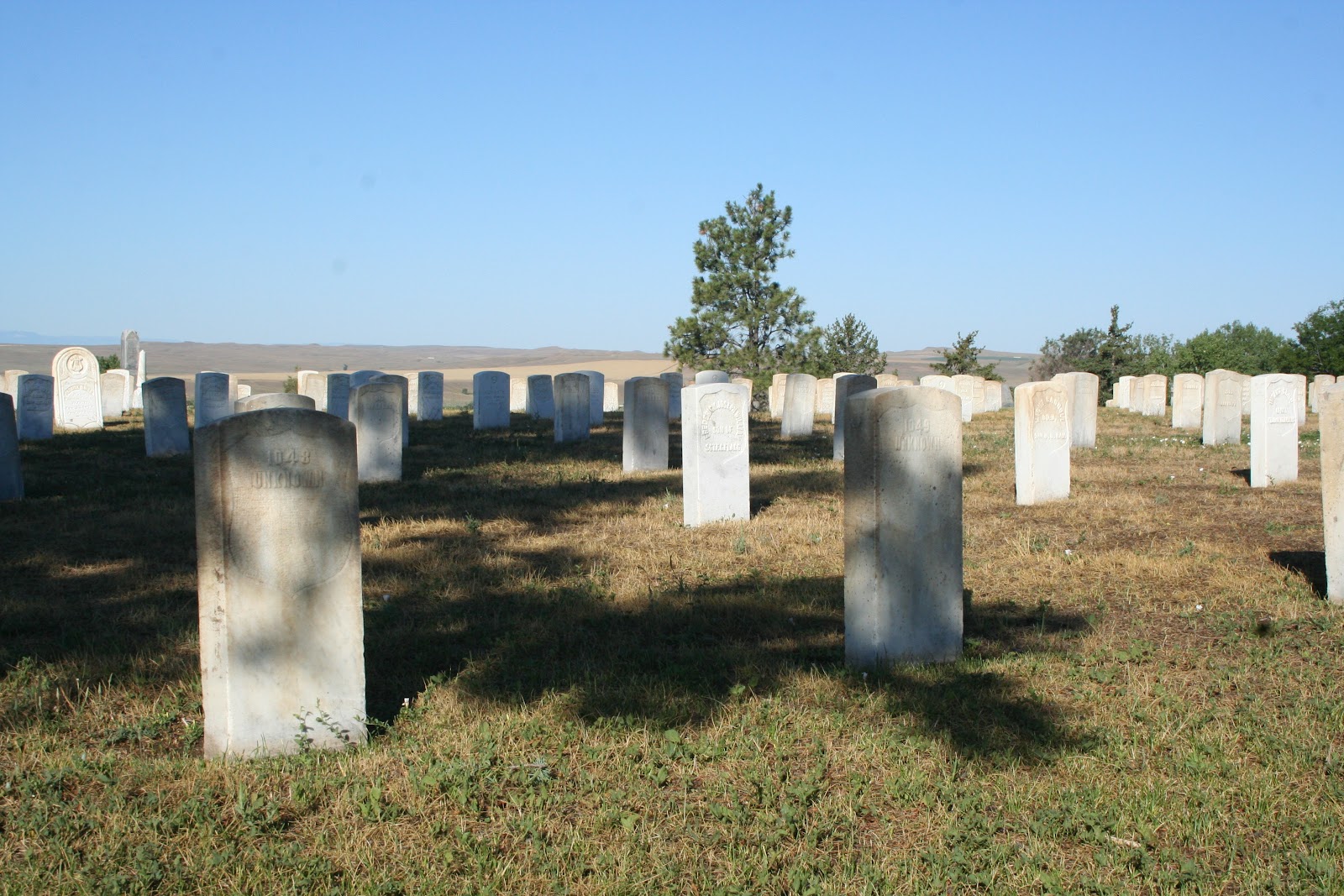
Like the day before, when we got to Little Bighorn, it was prior to the opening of the visitor center. We walked through the aisles of the National Cemetery there until the rangers arrived to open it.
Forever unknown
A solemn place of those born in Montana, South Dakota and other frontier territories
Originally the cemetery keeper's house
The museum piece of the visitors center tries to give a balanced view of the battle, something which is probably a relatively new perspective. Considering the different relationships between white men and Indians we'd already seen on our trip, we knew that this battle was originally seen as Custer trying to bring the "savages" to heel. Now, we see both sides of the story, where Custer was following the orders given, and the Indians were fighting to preserve their nomadic ways of life.
Custer's last stand
This memorial was erected in 2003.
There are few red monuments. 
The horses have their own monument
So does their farrier
So many of the dead were interred where they lie. So many were buried nameless.
It's a very sad battlefield. Custer was outnumbered, and frankly, out-maneuvered. The natives knew the land, and he didn't, and it cost him and his men their lives. Even if he had realized how badly he had misjudged things, history indicates he was too arrogant to admit his mistake, and the result likely would have been the same. 

This was the other place, along with Devils Tower, that dad thought he'd get to see "next time."
A photo posted by Karen (@kiirenza) on
We decided that he would feel most at home with Custer's men, where they fought a battle they could not win, much like he was doing with the pulmonary fibrosis. There was a small tree there at the corner of the gated area that had Indian prayer cloths tied in it, so it just seemed right to us.

Mom had never been to Montana before this, and the only place she really wanted to go was Glacier National Park. Unfortunately, we were seeing closures of the primary park road, Going-to-the-Sun Road, which would make seeing a glacier impossible for her. We pressed on, traveling I-90 westward, figuring we could monitor the situation and maybe visit on Friday.

What we did in the meantime was stop in Hardin, Montana to view the Big Horn County Museum, which seems to be in the process of recreating a small frontier community by moving one building at a time.

Not just buildings, but also this facade of a gold mine

I wish my classes were this small!

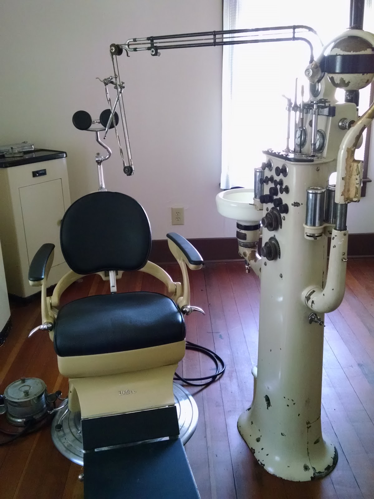
Doctor's office and pharmacy, all in one
A German church
An early petrol station
We made a quick stop at a grocery store in Hardin proper for some more craft beer and provisions, then continued on to Bozeman, where I convinced mom to stop for a short spell at a local craft brewery. Minutes after I posted a photo to Instagram and Facebook, my friend James responded, asking if I was in town. He was at the taproom less than fifteen minutes later.

While chatting with James, we learned some fun National Park Ranger lingo, such as "touron" and "bearjam." Used in a sentence, one might say :

We've got a bearjam on Grand Loop at Arnica Creek. Damn tourons.

Needless to say that mom and I swore to each other to avoid becoming tourons during our trip. :)

One of the tables at 406's taproom is shaped like Montana
We got as far as Butte for the night, and just before going to sleep, the road was still closed in Glacier. We weren't hopeful for the morning news.