So, that's what we planned to do. Except, I'd be on the tour by myself, since mom wasn't going to be able to negotiate the steps involved.
We arrived earlier than the museum opened, but there was plenty to see outside.
Minuteman II missile. It looks a lot bigger when it's not inside a silo.
I was the first to register for a tour, and so it was just a matter of moseying around the exhibits until the bus was there to load up. There was a ton to see, plus I was trying to figure out which of the multitude of postcards I wanted to purchase, so I was the last on board.
We were allowed to have recording equipment on the tour, but had to put it away during our security check at the gate. After we passed security, we got our drivers licenses back, then proceeded onto Ellsworth proper, where the first thing the tour guide pointed out was the auto hobby shop. :)
The facility is set up to show how they get a missile into the silo
Thankfully, we did not have to go through the hatch.
State of the art.... in 1970.
If you dropped something here, it became the property of Ellsworth. They weren't going to retrieve it for you.
Without GPS, the missile's guiding system was calibrated using this giant sextant and a small mirror on the surface of the missile itself
The mirror is visible here
It's weird to think that there are still silos out there, ready to take action. The hatch was a two part system, where no single person had both access codes. The "elevator" that actually took a person down inside the silo was so slow that it would take someone 45-60 minutes to descend. This wasn't a technology issue as much as it was a built in safety buffer. Since a single launch facility controlled up to ten silos, no one actually manned the silos. If someone was somehow able to get both codes, the slow descent meant that the motion detectors around the silo and subsequent response would have enough time to get to the silo before the intruder could get to the missile.
While I was gone, mom went to the grocery store, but hadn't returned when I got back. So, I explored some more.
Supreme Allied Commander Eisenhower's plane
Finally, mom returned, and we were off to Deadwood.
Which was a colossal disappointment.
Considering we were there on 7/30, just a few days before the official start of the 75th anniversary of the Sturgis Rally, there were a ton of motorcyclists, and too many of them were as ignorant as stereotypes would have us believe. The closer we got to Deadwood, the worse it was. In the end, we turned around and didn't stop anywhere. It appears that the current Deadwood is no better than South of the Border in that it's just a place to get tourists to spend their money.
Our next scheduled place was Devils Tower, but on the way there, we saw a sign for Vore Buffalo Jump. It seemed as good of a place as any to make a side visit to, since we'd scrapped Deadwood, and it was quite intriguing.
Turns out that Indians didn't just use steep cliffs for buffalo jumps. This site is in an ancient sinkhole, and was discovered when I-90 was being constructed. The original construction would have have I-90 go over top of the sinkhole, but when the roadway engineers went to check the integrity of the sinkhole (to see if it could just be filled in), they discovered layer after layer of bones.
Turns out that the sinkhole had been used for many buffalo hunts throughout history. Historians estimated that several hundred buffalo were herded into the sinkhole in each jump. The dead and dying animals would be skinned and parts harvested while in the sinkhole, and whatever wasn't used was left behind. There is a distinct lack of certain bones in the bonebed, considering their various uses by the Indians. For example, scapulae were used as hoes and shovels.
From the buffalo jump, we headed to Devils Tower, our last destination of the day. It was crowded as could be -- the line just to get in was 5-6 vehicles deep -- but with mom's "magic placard" (a handicapped permit), we had no issues with parking. We found a spot, went to the visitor center, then made the decision to hike the paved tower trail.
The initial part of the tower trail was kind of steep, but mom managed it fine. We wound our way around the base of the monument, up and down slight inclines.
It's pretty imposing up close
As an Indian holy site, there are a ton of prayer bundles tied to trees throughout
An old rope "bridge" used to scale the monument
About half way around the Tower, it was time for a "deposit."
This may have been tougher than the Badlands. This was one of the places that mom and dad had meant to visit, but decided it could wait until "next time."
Don't wait until "next time." Just don't.
I don't get why it's called "Devils" Tower. The natives call it Bear Tipi, Bear Lodge or similar names. It seems to me that the white man was scared of this monolith, while the natives found it inspiring.
We found a spot at the Sheridan KOA Kampground shortly after, as we wanted to get to Little Bighorn first thing in the morning to avoid the crowds.
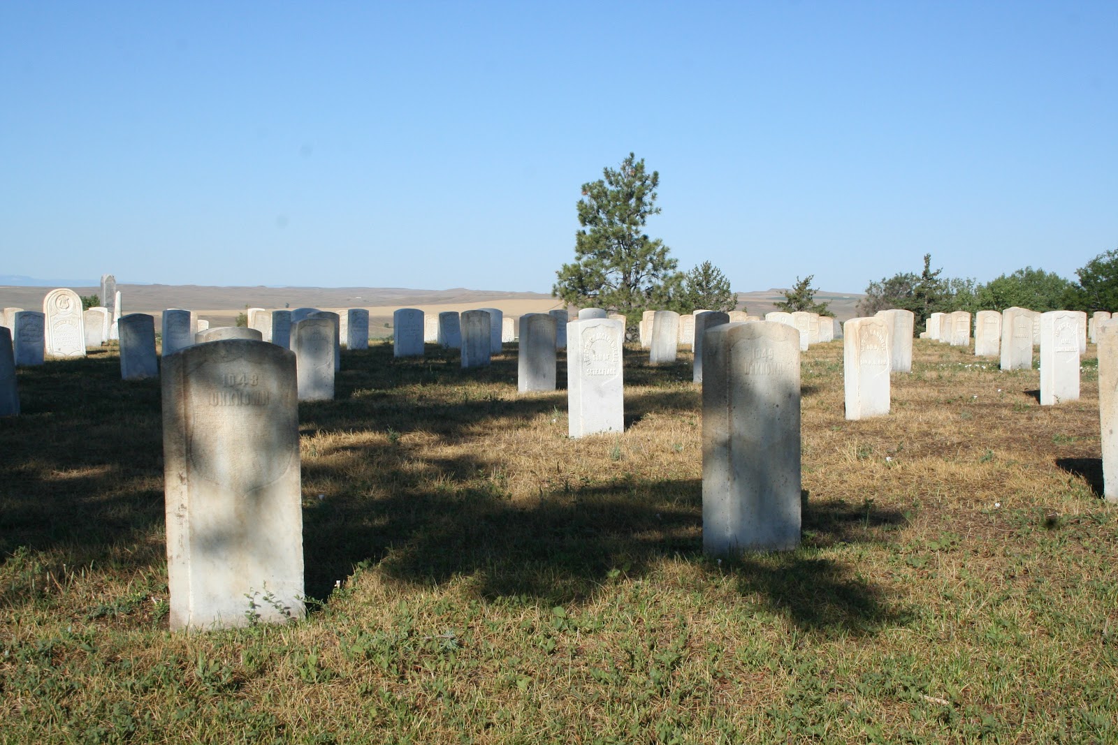
Like the day before, when we got to Little Bighorn, it was prior to the opening of the visitor center. We walked through the aisles of the National Cemetery there until the rangers arrived to open it.
Forever unknown
A solemn place of those born in Montana, South Dakota and other frontier territories
Originally the cemetery keeper's house
The museum piece of the visitors center tries to give a balanced view of the battle, something which is probably a relatively new perspective. Considering the different relationships between white men and Indians we'd already seen on our trip, we knew that this battle was originally seen as Custer trying to bring the "savages" to heel. Now, we see both sides of the story, where Custer was following the orders given, and the Indians were fighting to preserve their nomadic ways of life.
So many of the dead were interred where they lie. So many were buried nameless.
It's a very sad battlefield. Custer was outnumbered, and frankly, out-maneuvered. The natives knew the land, and he didn't, and it cost him and his men their lives. Even if he had realized how badly he had misjudged things, history indicates he was too arrogant to admit his mistake, and the result likely would have been the same.
This was the other place, along with Devils Tower, that dad thought he'd get to see "next time."
We decided that he would feel most at home with Custer's men, where they fought a battle they could not win, much like he was doing with the pulmonary fibrosis. There was a small tree there at the corner of the gated area that had Indian prayer cloths tied in it, so it just seemed right to us.
Mom had never been to Montana before this, and the only place she really wanted to go was Glacier National Park. Unfortunately, we were seeing closures of the primary park road, Going-to-the-Sun Road, which would make seeing a glacier impossible for her. We pressed on, traveling I-90 westward, figuring we could monitor the situation and maybe visit on Friday.
What we did in the meantime was stop in Hardin, Montana to view the Big Horn County Museum, which seems to be in the process of recreating a small frontier community by moving one building at a time.
Not just buildings, but also this facade of a gold mine
I wish my classes were this small!
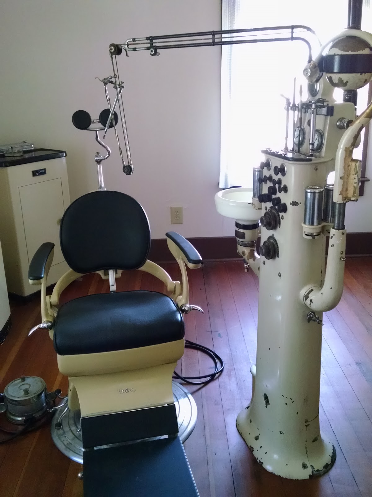
Doctor's office and pharmacy, all in one
A German church
An early petrol station
We made a quick stop at a grocery store in Hardin proper for some more craft beer and provisions, then continued on to Bozeman, where I convinced mom to stop for a short spell at a local craft brewery. Minutes after I posted a photo to Instagram and Facebook, my friend James responded, asking if I was in town. He was at the taproom less than fifteen minutes later.
While chatting with James, we learned some fun National Park Ranger lingo, such as "touron" and "bearjam." Used in a sentence, one might say :
We've got a bearjam on Grand Loop at Arnica Creek. Damn tourons.
Needless to say that mom and I swore to each other to avoid becoming tourons during our trip. :)
One of the tables at 406's taproom is shaped like Montana
We got as far as Butte for the night, and just before going to sleep, the road was still closed in Glacier. We weren't hopeful for the morning news.
So, eight days on the road, and we haven't killed each other yet. ;) I write this from our RV while parked in Cascade Locks, OR. If you've seen my Instagram, you've seen several photos from the trip along the way. If you've seen Facebook, you've seen.... a handful of photos.
We've seen a lot since last Sunday. After leaving the RV Park, we headed over to Kelley's Island to see some grooves left by glaciers. They are among the largest and best preserved glacial grooves in the country. It's sad to know that there used to be even better examples on the island, but they were destroyed by quarrying for limestone.
After Kelley's Island, we headed into Indiana to the Dunes, then across Illinois to Wisconsin. It was raining in Wisconsin as we crossed the Mississippi, and missed the lock we wanted to visit; construction kept us from accessing it. Overall, Tuesday was a disappointment, with the Blue Mounds being too far from the parking area for mom to hike to. We did see a statue of the Green Giant (ho ho ho) in Blue Earth, Minnesota, and found a really good beer store there, though.
We spent more time in South Dakota than I thought we would. We hit the Corn Palace first thing on Wednesday morning, then went to the Minuteman Missile Visitor Center, only to find out that the tours to the Delta-1 Launch Control were all spoken for for the day. So, we went to the Prairie Homestead and the Badlands, then looped back around to see the Delta-9 silo and then Reptile Gardens in Rapid City before calling it a night. The next day, we decided to go to the South Dakota Air and Space Museum, and I did the Minuteman Missile Training facility tour on Ellsworth AFB. That was awesome. The whole museum is awesome, and I would certainly suggest visiting it.
After that, we swung by Deadwood, and we were pretty meh. Nothing seemed worth stopping for. So, we headed west and ended up making a side stop at the Vore Buffalo Jump before going to Devils Tower.
Friday, we got to the Little Bighorn Battlefield just after opening, and were able to see quite a bit before the foot and vehicle traffic became too heavy. We stopped randomly at the Big Horn County Museum, and in Bozeman for a visit with my friend James, then called it a night in Butte.
Saturday was random day. We were going to go to Glacier National Park, but with mom's limited mobility, the only way she was seeing a glacier was at the singular glacier viewing point from Going-to-the-Sun Road. However, wildfires had that part of the park road closed, so there was little point in us going all the way up there if she wasn't going to be able to see the park's namesake. So, we ended up stopping in Deer Lodge at the Grant-Kohrs Ranch on a whim, and while there, it was suggested by one of the rangers that we go by the National Bison Range. So, we went there afterwards and were treated to close encounters with elk, bison, pronghorn antelope, and mule deer!
We made it to Ritzburg, Washington afterwards, trying to avoid wildfires that were within 100yds of the highway in Sprague. It was an uncomfortable situation, seeing those fires so close, and seeing the firefighters working so hard to contain them.
Today, we made a quick stop at the Wild Horses Monument on the Columbia River in Vantage, then drove through Naches and Packwood on our way to Mt. St. Helens. While in Packwood, I saw that someone was holding an autocross on the Hampton Mills site, so I begged mom to stop for a little bit so I could say "hi" to some people. Of course, some people were trying to get me to drive or at least ride along, but I avoided the temptation. Obviously, we went along to Mt. St. Helens afterwards, and called it a night here.
Tomorrow's supposed to be the John Day Fossil Beds and Crater Lake, with the Giant Redwoods and Yosemite coming up on Tuesday. We'll see. There are more wildfires in Oregon, and that could impede out progress.
I'll upload photos later when I get a better connection.






 Posts

