Translate

Showing posts with label camping. Show all posts

Sunday, January 1, 2023

Wake Up To a Brand New Day

It's 2023. Yay. No, I'm not particularly excited about it. The last few years of societal collapse around a maniac as President and the subsequent pandemic and just decreasing lack of civility and compassion has worn me down. 

Still, I wanted to think about things I wanted to do better for this year. I mean, I make "new years resolutions" at every "new year" chapter, whether it's the start of the school year, the start of the summer or whatever, so it's really just an exercise in putting the thoughts out there, and then trying to make them manifest. 

Instead of just vague objectives though, I'm going to take a page out of my teaching book and try to make them "SMART goals" with time sensitive, measurable and attainable attributes.

1) Hike at least once per month. This one should be easy. If I can do more than once per month, that will be even better, and I want it to be a real "once per month" not an average over the year. This might work well if Pat has a resolution to fish at least once per month. If I can bundle this with camping, it would also likely help my mental health a thousand-fold.

The C&O Towpath is one of my go-to places for hiking

2) Blog here at least once per month. Yeah, that seems like a low hanging goal, but considering "blogging more" hasn't worked out too well, making this something measurable, time sensitive and attainable seems more realistic. Maybe I'll even finish the "writeup" from last year's road trip before this year's. 

3) Read at least one chapter in a book at least five times per week. Seems weirdly specific, I know. I'm very disappointed in how much I've read the last few years. So, again, I'm trying to make it measurable (one chapter) and attainable (5+ times per week). Will I read more than one chapter and more than five times per week? Maybe. Hopefully. I'm still working on The Queen's Weapons, which I bought in March of last year, and finally started just before Yule.

4) Exercise at least 20 minutes at least four times per week. Again, it may seem like an odd goal, and why not the recommended "30 minutes"? Because I am still subscribed to Centr, and some of the sessions there are 25 minutes, and not a full 30. Like the previous resolutions, I would like to do more than four times per week when I can. Hopefully, sickness doesn't derail this particular goal, as it often does; the most recent bout with COVID-19 over Thanksgiving break derailed a good run started after my "second marking period resolutions". Of course, hiking any particular day would tick off this box as well as the first one.

And now for a few more difficult ones to attain....

5) Make strides towards National Board Certification every week. This can take different forms, depending on which component I am working on, but I do need to do this, since I really dropped the ball last year and it turns out that you can't last minute this like you can a fifteen page term paper in college. I will start this right away this week when I go back on Tuesday. 

6) Sell the WRX and get a reliable new(er) car. This breaks my heart to write out, but if I don't commit to it, I don't think I will ever go through with it. I haven't driven it since April of last year because the brakes need to be redone, and while I have all the parts to rebuild the front calipers (and my brother did the work of removing the seized pistons from the calipers I have for rebuild), I just haven't sat down to do it. Part of it is fear of doing it wrong, I know, and part of it is also knowing it's a PITA to swap a caliper much less two of them. I did a caliper on the black Camaro years ago, plus I did the front calipers on the green Camaro when I upgraded to LS1 brakes after finding a pair up for grabs at the pull-a-part junkyard. Anyway, once I get the brakes done -- let's set a timeframe of "by Spring" for that -- then the car is going to be officially for sale so that I can use whatever I get for it for a down payment on a new(er) car that has a warranty and all that. 

No more road trips to the Salt Flats in this car

7) Feel like I've done something worthwhile everyday and making note of it. I don't know how else to phrase this one. Those who know me know that I suffer from depression, and a lot of that revolves around constant feelings of worthlessness. So, making strides to feel like I've accomplished something, no matter how small, and acknowledging that accomplishment in some away will be tough. I have a little journal at work that I have used off and on since autumn 2019 where I try to do this. I try to write at least one positive thing about the day, no matter how minor, and then one thing I wish I could change and how I could change it (a "delta"). The framing is important -- it's just not something bad, but something I wish had gone better and (this is the important framing part), how I might have done things differently or what I could do to change the outcome. 

I think with this last goal, it's about the negativity that permeates everything these days, and I just need to try to find the positive out there, somewhere. Oh, hey, I put together this coat rack today! Check it out, I mowed the lawn! I got out of bed and took a shower! I read that chapter in a book and hiked today! 

It's 2023. 


note : some links are associate links where a click will result in minimal compensation to me if you also make a purchase through that link


Friday, August 19, 2022

Wanderlust in Full Force

(this is part 3 of an ongoing story; you might want to check out part 1 and part 2 first)

Stardate 100177.95... er, um, Sunday, July 31, 8AM. I was awake, and I still had no plans. So, let's just do what Beefy wants and drive west.

This resulted in I-70 towards Kansas City, and I got off the interstate at Boonville to see that area of the Katy Trail, which is one of many former railroad rights-of-way that have been converted to a hiking trail. 

Here, I learned about the town of Franklin, which was the seat of Howard County in the Missouri Territory and the largest town west of St. Louis. Oh wait, you haven't heard of it? It's not on a map? That's because it was destroyed by Missouri River flooding. The last straw was 1828, and those who survived just abandoned what remained and started New Franklin instead. 

A flourishing town used to exist here.

Tall bellflower along the rail trail

I decided to go back into Boonville proper and see what else I could learn about the Katy Trail, the Santa Fe Trail, and how the Boone family related to the area. Of course, the first thing I notice is the Isle of Capri Casino, a "stationary boat on the Missouri River" docked at Boonville. I ignored it and followed the Katy Trail to the former Boonville Depot.

The full name of the Katy Trail is the Missouri-Kansas-Texas Railroad, or MKT Line. 

I then followed the spur trail over to the lift bridge across the Missouri River. It is currently "permanently" in the raised position. 


Looking at the Missouri River (upstream)

The lift bridge from the current road bridge across the Missouri River

I went over to the Boonville Rivers, Rails & Trails Museum (and Visitor Center) after perusing the bridge. There's a lot of history in the area! From Lewis and Clark making their way up the Missouri River, to Civil War History, to the MKT Railroad, to Will Rogers attending the Kemper Military Academy.... there's a lot going on here. 

The original plans for the MKT railroad lift bridge over the Missouri River

Evidently, before the lift span, there was a pivot bridge for the railroad river crossing, and the lift bridge was designed around 1932. 

A recreation of Lewis and Clark's river boat was present


A door from Kemper Military Academy, from when Will Rogers attended

Boonville was involved in the Civil War from the start (1861) through the bitter end (1864)

From the town proper, I decided to go out to the Boone's Lick State Historic Site to see what that was about, since it was mentioned at the Visitor Center and at the interpretative panels about Franklin that were at the Katy Trail trailhead. It was about fifteen minutes away.

Daniel Boone's sons set up salt extraction here, as did many other pioneer families in the area. Not much remains on the short loop hike. 

Part of the Lower Spring Complex

The lower spring complex would pool the salty water of the spring. The water would be sent to the close by salt furnaces via a sluiceway. There were upper spring complexes too, but not part of this hiking trail.

The salt furnaces were next to this part of the stream

This lump is what remains of the ash pile from the salt furnaces

On the way back up to the parking area, I discovered a veritable forest of tiny pleated mushrooms. If I didn't know any better, I would have thought I'd discovered the Smurfs' village. 


There was also a toad in the area. I couldn't get a photo of it with the mushrooms.

Not much else caught my eye as I headed further west along I-70. I decided to stop for the night in Grand Island, Nebraska, which necessitated a shift up to I-80 outside of Kansas City. I pulled into the campground at sunset. 

Sunset in Grand Island, NE

Ursa Major at Grand Island, NE

I was greeted by another toad in the morning. 

I'm assuming it's a different toad since I'm a few hundred miles away from the other one

After a small breakfast and a short stop at a Cabelas in Kearney, Nebraska, I decided to see what was going on at Niobrara Scenic River. Before I got there, however, I entered the Nebraska National Forest at Halsey, where I ended up stopping for a while. 

Outside the ranger station, there was a very noisy cicada that I examined. It sounded and looked different than what I was used to back in Maryland, and Seek (iNaturalist) identified it as a Plains Cicada. The ones here in Maryland are more black and green, with dark eyes. 


Plains cicada

I went up to the Fire Tower so that I could see the surrounding Sand Hills. It was a good choice. 


The inside of the fire tower looks like a time capsule


The Sand Hills cover almost 25% of Nebraska

Niobrara wasn't much further away. The historic Bryan Bridge was one of the first structures I encountered. 

Built in 1932

After stopping by the visitor center in Valentine to say hi to Ranger Perrett, who was part of the #STEAMinthePark Mammoth Cave group, I headed out to Fort Falls to hike around a bit. This section of Niobrara is really a mixture of National Wildlife Refuge and National Park Service Site. 

Fort Falls

Beefy on the banks of the Niobrara River

My final destination for the night would be the Black Hills of South Dakota. I wanted to see sunset at Norbeck Pass again. From Niobrara, it was an easy trip, cutting through the Pine Ridge Indian Reservation where I briefly stopped for some groceries. I got to the Badlands KOA with plenty of time to check-in, eat a quick dinner, and set up my tent. Then, it was time to head over to the Badlands to see the sun set. 

I stayed until nightfall

A panorama of the sight

As night fell, I started to head back to the campground.

Moon over Badlands

The Badlands are one of those places where you can actually see so many stars when the clouds stay away. It looked a little on the cloudy side, so I didn't think the nightly ranger program would have much to say (like the last time I was there in 2018). I should have gone, because the clouds thinned out and even at the campground, I could see so much. 

I knew I'd be going through the rest of the Badlands in the morning, with little plans after that. Maybe Wind and/or Jewel Cave? Maybe.

note : some links are associate links where a click will result in minimal compensation to me if you also make a purchase through that link

No Particular Place to Go

(this is part two of my 2022 road trip; part one is here

Getting out and about on Friday was a struggle. 

My traveling companions

After I managed to get up, grab a bite to eat and pack up the tent, I sought out a place to fill up the gas tank and get some more ice. I found myself in a little town called Bolivar, on the Tuscarawas River. I considered going to the Fort Laurens Museum, but then for some reason decided to go to Bolivar Dam instead.
Bolivar Dam on Sandy Creek

I wandered around the path a little, and thought, "I think Pat would say this place looks fishy." I decided to look at how much a one-day out-of-state Ohio fishing license would cost, and if it was less than $20, I'd fish for a little while for the heck of it. 

It was $14. Fish on!

Looking down to the "fishy" area

Settling in, judging the best spot to cast from with minimal chance of treeing it

I started with a "ned rig" which got nothing. So I switched to a Whopper Plopper (top-water lure)

Yay! It may be little, but it was a largemouth bass on a top-water lure, so it was good.

After switching from a ned rig with a coppertreuse Z-man Finesse TRD worm to a "yoda" Whopper Plopper, I started to see interest from the small (6-8 inch) largemouth bass in the area. I finally not only enticed one to bite, but stay hooked until I could land it. 

Minutes after that, I saw feeder fish scrambling to get away from something out by the turtle basking logs in the middle of the creek. I cast in that area. 

It bit. And it fought. And I had it barely out of the water and was reaching for it when it unhooked itself and swam away. It was a chunky 16-ish (maybe larger) inch largemouth. It kept antagonizing the feeder fish while I kept trying to entice it to bite again. I tried Reaction Innovations Skinny Dipper swimbaits, went back to the Whopper Plopper, and nothing. 

More and more turtles showed up to watch the show during the two hours I was here

I'd only planned to stay maybe an hour, but that stupid fish that got away made me stay another hour trying to get it back. It was still a fun diversion, and I caught more fish than guys that showed up for 30 minutes with their catfishing gear (I caught the first fish as they were leaving and they saw me bring it in). 

From the dam, I drove south on I-77 and thought about visiting Hopewell Culture, since I hadn't been there in several years and I'd gone to Cahokia Mounds last year. Instead, when I stopped for gas outside Newark, OH, I saw a sign for the Great Circle Earthworks -- another Hopewell site -- and chose to go there instead. 
The entrance to the circle, looking directly at the Eagle Mound

Photos alone really can't do justice to this structure. The circle itself is 1200 feet in diameter, with an arrow shaped mound in the center that is called Eagle Mound. Archaeologists found the remains of a wooden structure in the mound, and think it may have been a ceremonial building that was intentionally burned and buried when the inhabitants left this site. 

Inside the circle wall is a ditch which was probably full of water when this area was inhabited. It's thought that the circle symbolized the turtle in an ocean, an Indigenous motif of the world in the universe. 
The inner ditch just inside the entrance to the circle
I was being watched while I walked around the interior of the Great Circle
 
Standing on Eagle Mound, looking towards the opening to the Circle

A nearby Hopewell site and part of the Newark Earthworks is called the Octagon. It is only somewhat open to the public because it's been leased to a country club since 1910. This actually upset me, because both the Great Circle and the Octagon were evidently sacred sites tied to the moon, and in fact may have represented the moon at perigee and apogee. Fortunately, I have since discovered that I'm not the only one disgusted and angry that an historical and sacred site (one that is part of a nomination as a UNESCO World Heritage site), and that the battle to remove the country club (has gone to the Ohio Supreme Court). Here is a NY Times article on the subject from 2021. Of course, if this truly was a lease to the country club (which, according to the article, runs through 2078), there should be provisions for ending the lease early. 


Part of the view from the viewing platform, which Moundbuilders Country Club considers "open access" to the grounds by the public.

The golfers can walk on the earthworks for a shot.
Observation Mound, from which Woodland period native peoples would have watched moonrise. This view is from the "public access" trail.

From the Octagon, I headed south through Cincinnati into Kentucky, thinking maybe I'd try Mammoth Cave in the morning. I made a reservation at a KOA in Horse Cave and set Waze to get me there. Construction on I-65 at the Horse Cave exit backed traffic up by two miles, making the trip take almost an hour longer than it should have, so I found myself putting up the tent in the dark. The Horse Cave KOA is not very tent-camper friendly, as the tent area is not flat, and is about as far away from the restrooms/showers as can be. In the dark, it was difficult to find my site, especially with no clear place to park the car. 

At least there was a little bit of firewood left in the firepit, so I started a short-lived campfire.

The next morning, I looked at Recreation.gov for cave tours at Mammoth Cave, and it looked like I wouldn't be able to get anything that I haven't done previously. I contemplated my next steps while avoiding the group of murder ducks wandering the campground, as well as a loose dog that was looking for a friend. 
Murder ducks. It's like being in Hershey all over again. 

What do you guys what to do today?

In the end, I decided to skip Mammoth Cave and go to Hidden River Cave instead. It was only about ten minutes away from the KOA, and when I got there, they waved me right into the tour. 
This is the Horse Cave, because when it was first settled, "horse" was just a term for something really big. It's now called Hidden River Cave.

The river is right at the bottom of the opening, and you follow along it a little ways before going into the other two dome rooms. This is a cave much like Mammoth in that it has domes and very few "wet" formations like stalactites, stalagmites, flows or columns. And of course, the "big sell" for Hidden River Cave is the bridge, which was more than a little nerve wracking for someone like me who doesn't like bridges. 

The hidden river

No one wanted to be the first (behind the guide) across the bridge

One of the few places of "flowstone"

Sunset Dome, the third of the three rooms on the tour

Heading back out of the cave

The American Cave Museum is part of the Hidden River Cave tour, and explains how the cave reflects an ecosystem that was nearly destroyed by the town basically using the cave as a sewer.... which then almost killed the town, since their drinking water originated from the cave. The cave had to be closed in the 1940s because of the pollution, and it was known as the most polluted cave in North America. Only after a new wastewater treatment facility was put into place nearby in 1989 did the cave ecosystem begin to recover from nearly a century of abuse. 

From Horse Cave, I meandered northward past Louisville and into Henderson, where just before crossing over the river to Evansville, IN, I saw a sign for John James Audubon State Park. I pulled in and immediately saw the Civilian Conservation Corps work. 

The Welcome Center, gift shop and museum are located here.

The museum is a paltry $6 to visit, and I would share photos, but due to copyright issues, you aren't allowed to take photos of the amazing collection of original Audubon works they have, including multiple copies of his Elephant Folio. There is also a comprehensive history of Audubon, who spent several years in Henderson, KY trying to find his way in the world. 

Of course, there were hiking trails, so I took the opportunity to stretch my legs. I saw birds, but also myriad other animals!

And fungi.... you know I saw fungi too!
A still and quiet pond

Green dragonfly, an Eastern pondhawk female

Five lined skink!

Eastern pondhawk male

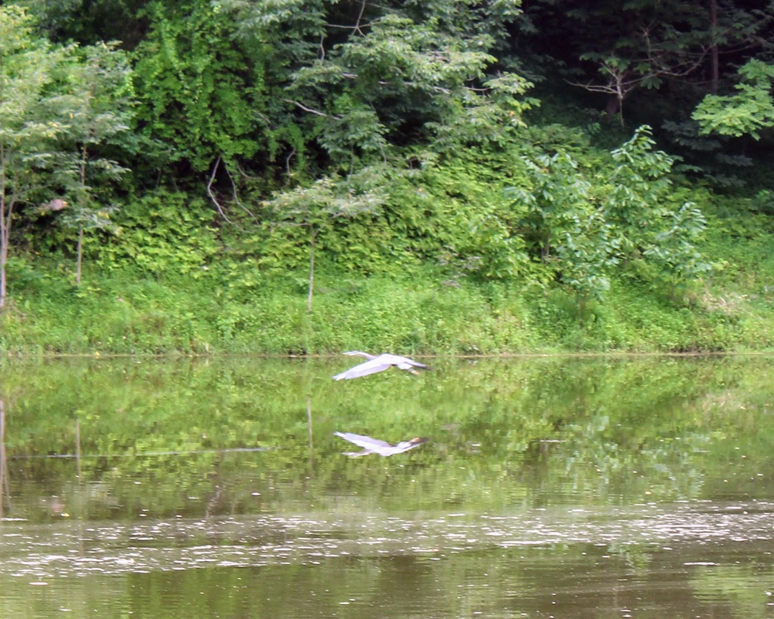
Heron

Two deer

I legitimately chastised some super loud children right after I saw these deer. They were basically yelling at each other in conversation, and I just shushed them and said, "You just scared away two deer, a duck and who knows how many turtles." The kids went silent and I continued, "You probably haven't seen anything since you're so loud. If you want to see the animals, you need to be quieter." The parents just looked at me.

I walked away (they were going in the opposite direction I was), and I didn't hear them again. 

A CCC constructed shelter, marking where the overlook spur branches from the main trail

Built in the 1930s, renovated as an Eagle Scout project in 2000, and still needs protection from vandals

Turtles basking

Plainbelly watersnake, maybe

Hummingbird sculpture based on an Audubon painting

Butterfly on a coneflower

I decided to call it quits outside St. Louis, and got a tent site at a KOA I've stayed at before. The tent sites there are okay; they are flat and somewhat close to the renovated restrooms/showers, but they are also buggy. 

Campsite for the night

Buggy campsite also means spiders

A friendly lightning bug that looks just slightly different from the Maryland variety

I cooked up some "Forever Young Mac and Cheese" for dinner, and it wasn't as good as the spicy sausage pasta. Maybe it would have been better if I had some Old Bay to put in it. I still had no itinerary besides being in Salt Lake City by next Friday, so I figured I'd just drive through St. Louis, take I-70 for a while and then either find some things in Kansas or head up towards Lincoln, NE. 

But first, sleep. 

note : some links are associate links to sites where I received minimal compensation if you make a purchase through the link