Monday morning, August 3rd, we started our trip to Crater Lake by backtracking a mile or so to the Bridge of the Gods in Cascade Locks. I'd seen it the evening before, and wondered what it was.
The current Bridge of the Gods
A mural depicting the "original" Bridge of the Gods
Native legend says there was a land bridge across the Columbia near this site, and the local tribes referred to it as the "bridge of the gods." When this bridge was constructed, it borrowed the name.
We had two places in mind for Oregon -- the John Day Fossil Beds and Crater Lake. The fossil beds had a few locations, and we plugged one, Clarno, into the GPS. It was in the middle of desolation.
And turbines. Lots of turbines.
Dilapidated
Abandoned and kind of creepy
Finally, we arrived at the Clarno Unit, which turned out to be just an outpost of the main site. Still, we hiked around the Geologic Time Trail, and were able to make out a handle of fossils there that hadn't been damaged by fossil hunters.
The Palisades
Impression of a plant left behind
One thing we learned here was "Who was John Day?" Turns out he wasn't associated with the fossils at all! He was a trader who'd been robbed of everything and his story and the place where it happened became so infamous, a town and river were named for him.
Once back to the RV, we decided to go to the visitor center at Sheep Rock so that mom could get her Passport stamp. As we approached the area, the rock formations took on extremely vibrant colors, from blue-greens to orange-reds. It reminded me somewhat of Fossil Butte. The visitor center's displays were awesome.
A small pond turtle, just barely larger than my fist
An Easter Bunny?
Beardog!
Mom wasn't up for much more hiking so our "deposit" here, where so many early turtles were found, wasn't in such dramatic scenery.
Clemmys is a genus name of pond turtles, including the spotted turtle (Clemmys guttata) and the bog turtle (Clemmys muhlenbergii) that are native to Maryland.
We called it a night in La Pine, Oregon, finding a place at Cascade Meadows RV Park. We'd passed by signs for Newberry Volcanic Monument and associated lava tubes, but as it was after closing time for the visitor centers, we continued on. I hated thinking "next time," I absolutely hated it, but I hadn't had it on my tentative itinerary, and so it would have to wait.
Crater Lake was our Tuesday destination, and we entered via the North Entrance Road, which links up with West Rim Drive. West Rim Drive is.... interesting, and if you're afraid of heights, it is probably anxiety inducing. Mom was certainly stressed in the passenger seat at the dropoffs next to the road, especially since there was no guardrail at most of them. There was even one short section that had dropoffs on both sides of the road for fifty or so feet. Thankfully, nothing was coming the other way.
We stopped at an overlook along the Devils Backbone, then continued on to the Rim Village.
It was still early, and fog shrouded most of the lake.
A fat little ground squirrel was looking for edible droppings
The visitor center and Sinnot Memorial Overlook had just opened when we arrived, and I did a quick jaunt down to the overlook to make sure mom was going to be able to navigate it.
A plush-crested jay at the top of the walk leading to the Sinnot overlook
I suggested that she at least use her walking stick, and we wandered down the trail. The fog was starting to dissipate a little bit.
Wizard's Island
As the fog lifts, some of the sapphire blue water is visible
Mom had last been here in the sixties, during a short time in her life when her family had briefly moved to Klamath Falls. She had come in via the south entrance and gone to Rim Village, but it was different than the current setup. She also had come while there was still significant snow on the mountain, telling me about huge drifts next to the road as they ascended.
We headed down the East Rim Drive towards Mazama Village, to see if the National Passport stamp at that visitor center was any different and if they had any different post cards. We mailed a postcard to Allison here (there's a post office in this visitor center), and then we started our trek towards California.
We found ourselves traveling along the Rogue-Umpqua Scenic Byway, and decided to stop for a few moments at a wayside of the Rogue-Siskiyou National Forest. This turned out to be the Rogue Gorge.
The "cave" at the top is a partially collapsed lava tube. There is a second lava tube at the bottom, plugged with a large piece of basalt
Zombie stump. The roots are joined with the tree next to it, so it will never actually die unless the other tree does.
Another lava tube
I'd never driven across the California state line before, so I wasn't aware that there was a "check" for plants, fruits, etc. We passed, and continued towards Crescent City and Redwoods National Park.
Yeah, Redwoods. We opted to see the tall trees versus the sequoias because Yosemite was further south than mom wanted to go, plus the pop-up wildfires were more of an issue if we went that way. So, Redwoods it was.
Even if they are the smaller in diameter trees, they are still giants compared to the every day trees I see around here. Combined with ferns and and dense undergrowth, the forest seems otherworldly and prehistoric.
I used my telephoto lens for this. I did not want to venture too close.
The coastal highway had a few vantage points for great shots, and we stopped here and there to try to capture some pictures before meeting CA299 and turning back towards the east.
It was becoming time to try to find a place to stop for the night, and this would prove to be extremely difficult in the sparsely populated area. In the meantime, I convinced mom to stop at the "drive through tree" in Klamath. The woman at the ticket counter said the RV wouldn't fit through, but we could still go up to take a picture with the tree as if we were going to drive through.
Turned out that the little road to the cul-de-sac up was pretty steep and the trees had branches down low enough that they got tangled up in the RV's television antenna. Thankfully, my brother had installed a ladder on the back just before the trip, so I climbed up and broke off the branches before they could damage the antenna. Mom drove up to the tree as if she was going to drive through (I'd already decided on the caption for this photo, and we both thought it was funny as hell), and I took a few pictures.
After a few disappointments, we finally found a place to stay in Junction City. It turns out that Bigfoot is pretty big in the area, so in addition to being the namesake of the RV park, according to my friend Bret, there's a museum too!
We spent the evening laughing over a video of Bruce the Spaz Dog that Pat had sent us a few days previously, because it was still that funny.
This is part V of an extended version of the yearly road trip writeup. You may wish to visit Parts 1, 2, 3 and 4.
Evanston in the morning is a bit chilly, but I was still a little worried about the weird vibration from the night before. As I was checking out, I asked the hotel clerk if it was going to be a problem for me to be removing a wheel from and possibly working on my car in the hotel parking lot. Her response was, "This is Wyoming. You can pretty much do what you want here." With that blessing, I jacked the car up and pulled the passenger front wheel.
No missing weights, no loose endlinks, nothing I could see to account for the vibration. There were a lot of nasty bugs stuck on the inside of the wheel, but I didn't think they could affect the balance that much. But, on the off chance there was something I couldn't see, I took it to a DIY car wash, where I promptly managed to cut my knuckles on the front license plate and bleed all over. Nice. I considered it a blood sacrifice to make it to Toledo safely, and then got on the road.
There was no drama on the trek towards Green River, so when I saw the sign for Fossil Butte National Monument, I decided to jump off I-80 and head towards Kemmerer. It turns out that it's a lot further from the interstate than I thought, but that was okay, as I had plenty of time to get to Toledo before Wednesday night.
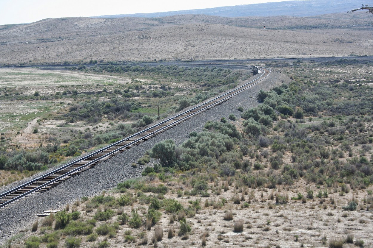
Random railroad crossing
Wish I'd been able to capture a train too.
I went through a cloud of locusts right after I washed the car. This one was still moving 10 minutes later. Ugh.
The colors of the rocks at Fossil Butte are amazing. Maybe they aren't as dramatic as the Yellow Mounds in the Badlands or the Painted Desert, but it's still a sight to see.
The visitor center has an incredible diversity of fossils from the beds -- plants, animals, seeds, embryos! Everything. If you can't visualize what that ecosystem looked like from their collection, you have no imagination.
Bowfin
Mioplosus labracoides, a predatory fish
Gar
Paddlefish with Knightia (the small fish)
Seeds
Knightia meeting a grisly end
Hummelichelys guttata with teeth marks in its shell
Echmatemys with teeth marks
Protohippus
Chisternon undatum, extinct
Soft-shelled Apalone heteroglypta (with Knightia)
This Axestemys byssinus was larger than me! It's another soft-shelled turtle
Stingray
I didn't take a lot of plant photos, but this frond (and a matching on on the other side of the case) was almost as tall as me!
A horsetail/rush, with several juvenile Knightia
Two different layers; these fish died many years apart
This guy was much more personable than the one at the Badlands.
Heading back towards the highway, I considered hiking the Historic Quarry Trail (2.5 miles roundtrip), but then decided that it might take longer than I wanted. So, it was back on the road, to US30, which I stayed on through Kemmerer and towards Green River until I saw a sign for "Granger Station". I didn't know what it was, but it was only 1/4mi off the road, so I detoured into the tiny town (less than 150 inhabitants) of Granger. The first historic marker I saw took me to a pioneer community graveyard.
Most of the graves here are unmarked and unknown. The last burial was in 1942, and it is mostly infants and children, but that is sadly typical of pioneer cemeteries.
The other historical site in Granger is the Granger Station, first established in 1850 as a wayside for those traveling the Oregon Trail, then later used as a Pony Express Station and as a train station. The railroad coming to town is what allowed Granger to incorporate as a town in 1914.
The main structure is about the same size as the Pony Express station in Gothenburg.
This additional portion may have been stables or something else in the past, but has long since gone into disrepair.
My curiosity got the better of me; I lifted up the boards and found a cobwebby well underneath of them.
The doors were nailed shut, but you could see through the windows the building was empty.
The railroad still passes through Granger to this day.
Another claim to fame is that Mark Twain once stopped at this very station, which I discovered after I'd left.
From Granger, I headed back towards Green River and then I decided to check out the Flaming Gorge. This is another one that I really wish had said how far from the interstate it was, since it was even further. With few paved roads as options across Wyoming, this would mean that I wouldn't get very much past Rock Springs within the first several hours of leaving Evanston! But some of the views were worth it.
It looks barren, but it's teeming with its own diverse lifeforms.
There are also tons of fossils throughout the Green River formations.
Once you get into the northern reaches of Utah, there are signs along the road saying which epoch or age you are at (like the Jurassic or Cambrian age).
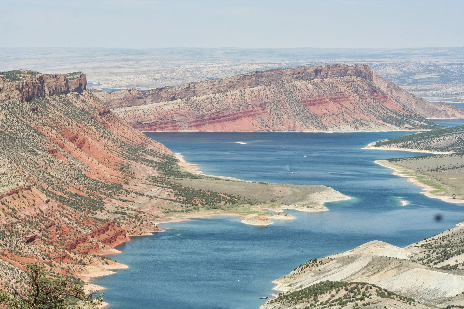
Around Sheep Creek Bay, you start to see some of the layers for which Flaming Gorge is named.
Sheep Creek Bay of the Flaming Gorge Reservoir
The road to the overlook
Swett Homestead from the Greendale overlook
I didn't see any. :(
Swett Homestead
Carter Creek Bridge from the Cedar Springs overlook
Carter Creek Bridge
Flaming Gorge Dam from the Visitor Center
They are very, very worried about invasive aquatic species in the Western states. This is from Lake Meade, after just 3-4 days in the water.
Flaming Gorge Dam
A real cowboy, herding cows towards a pond. He seemed amused by me taking a picture of him
Yellow rocks overlooking the Clay Basin
Clay Basin
Eventually, I made my way back to I-80 at Rock Springs, then pushed on towards Cheyenne and Nebraska. I knew my time away from the interstate was going to hurt me, but I was seeing such awesome stuff and meeting interesting people, so I didn't so much care. It was funny at Fossil Butte that one of the women at the Visitor Center saw my Washington Capitals hat and exclaimed how much her son would love to know that a Caps fan had stopped by tiny Kemmerer. Then I told her I was a season ticket holder, and she was extremely amused. But, I guess Caps fans don't venture outside DC too often, or if they do, they don't advertise their hockey affiliation. ;)
I tried finding a hotel in Sidney, Nebraska (home of Cabela's) to no avail, so I ended up driving another 90 long minutes to North Platte. The vibration had stayed away for most all of the day until I'd gotten into Nebraska, and it was still only in right hand sweeping turns at speed. If I was just changing lanes, it wouldn't happen, and if I slowed down to 60-70mph, it didn't happen. I was still perplexed, but I'd hopefully be in Toledo the next evening and PURE Tuning could look at it and hopefully fix it.






 Posts
Posts


