 | ||
| Pat couldn't explain the Koosh ball he found with his lures |
 |
| Looking downriver from our campsite |
I decided to head west, towards Shepherdstown, on my own bike. I'd been as far as mile 72 while hiking on foot, so I was determined to see the lock up that way. I was determined to see some cool stuff, like I'd found the weeks before at McCoy's Ferry and Fifteen Mill Creek.
It didn't take long after passing MM72 to see something cool.


Then, just past the railroad bridge, I see the remains of its predecessor.
 |
| The monolith loomed large in the forest. |
There were others, and it was clear that the bridge I'd just passed was the new-and-improved one.
Just a few yards beyond the silent monoliths was what I initially thought was lock 38, though its placement confused me.
 |
| Lock? |
But, upon further examination, I felt it was too close to the river to be a lock. Plus, there didn't seem to be any way the towpath could stay on the south side of the canal unless there'd been some divine intervention in the pathway of the Potomac River. I can only think now that it was a way of channeling water from the river into the canal, and so did sort of function as a lock of sorts.
The actual lock 38 was just a little ways west of this, and evidently can be seen from MD34 where it crosses into West Virginia.


I didn't quite get to MM73, so I didn't get a shot of it, but that's basically where lock 38 is found along the towpath.
Going back to the campground, I did make one small detour at Packhorse Ford. The sounds of the water rushing over the rocks and the scenery there was just too peaceful not to.
 |
| Abandoned snake skin |
 |
| Rushing water |
After getting back to the camp site, Pat was messing around with lures. He'd caught a catfish, but that was about it. He headed back out, heading where I'd just come from, looking for smallmouth bass or walleye (his real target). I bummed around the campsite for a little bit and gathered a bunch of twigs for use in the campstove. After putting the twigs in a plastic bad, I decided to go east, past the aqueduct. I'd been as far as mile 68 going that direction (on foot), so with the bike, I knew I could go farther.
Most of the time, I was under the tree canopy, but as I approached MM67, a few sprinkles were getting through the leaves. We knew there was a good chance of showers on both Saturday and Sunday (the reason I'd put the campstove fuel in a plastic bag), so it wasn't a total surprise.
And, just past MM67 was lock 37, complete with a lock master's house!
 |
| Lock 37, also called "Mountain Lock" |

 |
| Looking down in the lock from the pedestrian bridge |
 |
| The lockmaster's house seems to be in good shape from the outside |
 |
| Eastern end of the lock |
The sprinkling became more intense as I tried to take quick photos, so I jumped on the bike and headed back to the campground. Of course, the rain was done by the time I got back. So, I went down the little slope to the river. It was still, and the sun was reflected off the ripple-less water.


Pat came back from a fruitless trip, and we fired up the campstove for dinner. Despite the heat, he convinced me to start a campfire in the fire ring, and we sat and "chilled" by that for a few hours (and I roasted a couple of marshmallows) before settling in for the night.
 |
| About the largest the fire ever got. |
The birds woke me up in the morning. Tweet, tweet, tweet..... before 6AM. Ugh. Pat got up sometime after that, and I went back to sleep. The birds woke me up again, and I went back to sleep again. The next time, I decided to get up. It was about 8:15AM -- still too early for me, but between the sun shining directly into the tent and the tweeting, there was no way I could continue to sleep.
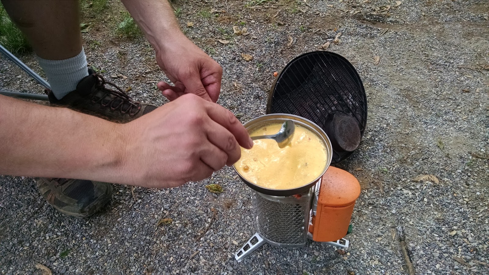
Pat had already gone fishing and returned -- empty-handed -- so he was ready for breakfast, too. I fired up the campstove, and we had our usual scrambled eggs and sausages.

So, I had thrown out the idea of me riding east to Harpers Ferry the previous night, and Pat was still good with it. My plan was to ride down to the Harpers Ferry area (about 10 miles) while Pat was fishing, and then he could pick me up somewhere along where the towpath and Harpers Ferry Rd. meet up. If I just rode straight there, it would take me about an hour, but we both knew I'd stop along the way to take pictures. We decided that whoever got to the Harpers Ferry area first would send a text to the other.
We broke camp and loaded up the truck. Then I headed off, and stopped less than a half mile away to get an obligatory shot of the aqueduct. I'd done enough aqueduct hunting the previous two weeks at Fifteen Mile Creek and McCoy's Ferry that I had to.
 |
| Antietam Creek Aqueduct |
 |
| Looking upstream of Antietam Creek, from the aqueduct |
I pedaled pretty much non-stop until I came up to MM67. There was a culvert there that I wanted to explore, since I hadn't the day before what with the rain.
 |
| At MM67 |
I was somewhat surprised by the condition of the culvert, as all of the ones I'd seen previously were in really good shape.
I continued down the towpath past MM66, and was going at a comfortable pace when out of the corner of my eye, I thought I saw something interesting across the canal.
 |
| Is that a cave??! |
The cave mouth was half my height, and it kind of gave me the creeps, so after taking a few photos while standing in the canal, I got back on my bike and started pedaling again. But just a few moments later....
 |
| It's an even bigger cave!! |
I was really ill at ease approaching this one. For one, it was tall enough that I could walk into it without bending over. There was also no human detritus around, as many such areas on the towpath would have. No beer bottles/cans, no graffiti, nothing indicating that people messed around here. It all added up to Stay Away!!! to me. So, I took a few photos while standing at the mouth of the cave, then left.
 |
| It went back pretty far. |
It wasn't too much farther down the towpath when I saw yet another structure that caught my eyes.
 |
| What do we have here? |
By standing on my toes, I got the impression that the stone structure obscured by trees might be a kiln of some sort. So, I crossed the canal to get a close up view. I had no idea what the wooden structure was; it wasn't a domicile. But the stone structure was certainly a kiln, most likely an iron works of some sort.


 |
| Oh, snap, what is looking at me???! |
So, as my exploring comes to a close, and I look back at the wooden structure, I see a vulture in an opening. It leans forward, looking directly at me. Now, I've seen horror movies, and I know this is the point at which the axe murderer sneaks up from behind. The vulture spread its wings and flew away, just as I turned around in terror and then sprinted across the canal, back to my bicycle. The next half mile went by very quickly.
I stopped briefly at MM65 because I could see a "detour" ahead. A culvert had collapsed, and the towpath had been rerouted into the canal proper. I suppose this will eventually happen with the culvert at MM67, considering it's already starting to crumble. Anyway, at this point, I also see I have a text from Pat saying to let him know when I get to the turnaround on Harpers Ferry Rd. Evidently, that's a perfect place for him to pick me up and toss the bike in the back. I let him know where I was, then continued to pedal.
There wasn't much until mile 64, and literally at MM64, I started to see turtles everywhere. I saw at least three different species in that first half mile after the marker -- a painted turtle (couldn't tell if it was eastern or midland), a stinkpot and a wood turtle. Because of the vegetation and the limitations of focusing my cell phone's camera, I really wished I had my digital SLR with me at this point.
 |
| This was right at MM64. There are two turtles and a frog. |
 |
| A little past MM64, I saw this wood turtle on a log. |
I finally came across a hiker-biker campground (Huckleberry Hill) after passing MM63. The distance between this hiker-biker stop and the next one (obviously past MM73, since I hadn't seen another one through lock 38), must be among the long distances on the towpath.
 |
| Neat looking tree roots at the rivers' edge at the Huckleberry Hill campground |
A short way past the hiker-biker campground, I stumbled -- almost literally -- upon lock 36. This lock has been almost entirely filled in with sediment. Strangely, the towpath trail takes a ninety-degree turn to the right as it passes this lock, heading straight for the river.
 |
| Lock 36 |
 |
| A white tail deer was grazing at the eastern end of the lock |
I followed the towpath to the right, and was greeted with a structure similar to one I'd seen near lock 38 the afternoon before, only this one had water in it.


Continuing on, I notice more stone structures to my right, where the canal should be. I stopped and looked closely.
 |
| Is that lock 35? |
Amidst all the vegetation and seemingly random stones, it certainly looked like an honest-to-goodness lock across the way. I started down into the canal area, but realized that there was still a lot of water at the bottom; if not water, then definitely enough mud that I didn't want to deal with it. So, I stood on tiptoe to see the apparent lock as much as possible.
 |
| Sure looks like a lock |
There was a wooden pedestrian bridge, and there is definitely a sign that says "lock 35". It's the lock. I just can't figure out how someone is supposed to get to it. I'm wondering if it's accessible from the lock-like structure after lock 36.
I pressed on, knowing that Pat might, at this point, be wondering where I am. I came across another stone structure that after subsequent review, might be part of Dam 3, then continued to lock 34, where the turnaround was located.
 |
| Possibly part of Dam 3? Just before MM62 |
 |
| Lock 34 |
 |
| Lock 34 |
 |
| Snapping turtle and frog in lock 34 |
I could have gone further than the turnaround, and maybe I should have asked to be picked up at Weverton in hindsight. But it turns out that Pat's possible fishing spots had been non-existent, and so he'd just been waiting for me to text him. :(
But with the bike, he knows he has a better range, and if he can find a way to carry his rods besides in his hands, that will make the range as far as his stamina will allow. We'll see.
Not sure if we're going to make it four weeks in a row. Final exams start next week, and I need to make sure my grades are in line before then. There's also a greater chance of rain than there was this past weekend. We'll see.


No comments:
Post a Comment